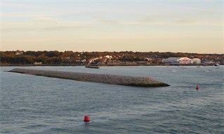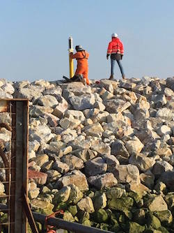
Cowes Harbour Commission (CHC) is pleased to report that contractors Boskalis Westminster have completed the installation of rock armour layers to the new detached Cowes Breakwater.
 Five navigation light beacons have now been instated along the crest of the breakwater, details of which can be found in Local Notice to Mariners No 37(T) of 2015. The steel docking piles used by the rock barges have been lifted out, and circa 6,000m3 of surplus gravel, currently at a holding position to the north of the breakwater, will also be removed. Contractor de-mobilisation will ensue with final handover of the breakwater to CHC due to take place next month. Harbour users are requested to note that the breakwater Exclusion Zone remains in force at this time; a Notice to Mariners will be issued once handover is complete and the Exclusion Zone has been removed.
New harbour tidal model
As agreed by Cowes Harbour Commissioners following the July 2015 project review, CHC has prioritised the completion and verification of a new tidal model with consultant hydrodynamic engineers ABPmer.
This new ‘overall’ tidal model covers an extensive area including all of the English Channel and parts of the North Sea, which is essential to more accurately simulate a wider range of tidal conditions within the area of interest in the Cowes Harbour and Solent ‘local’ model. The new model is built using a flexible mesh, which allows for better control and fine detail interrogation and analysis.
Comprehensive calibration reports for both the ‘overall’ model and the ‘local’ model have been completed; these detail the calibration and verification of the model against actual water levels and currents in multiple locations, both in the regional and local Cowes and Solent areas.
To provide additional assurance the modelling development and calibration reports have and continue to be reviewed and scrutinised by independent experts.
Sedimentation studies
Subsequent to the project review and in support of ABPmer’s July 2015 Sedimentation Report, Cowes Harbour Commission has committed to continuing to review all evidence and data to improve current understanding of the Cowes Harbour baseline sedimentation budget and its main drivers and sources (local, Solent and south coast environmental changes, natural and man-made interventions).
CHC is therefore set to commence a programme of sedimentation sampling and monitoring throughout Cowes Harbour and the River Medina, designed to provide further information and data for ABPmer’s modelling programme and also as part of a longer-term sedimentation-monitoring scheme for the harbour. This monitoring programme will combine a comprehensive bathymetric programme and long-term sedimentation monitoring that will be used to assist the understanding of the sedimentation system and for the development of a new sustainable dredging management plan for the Medina Estuary.
Next phases of harbour infrastructure
The new ‘local’ tidal model will now be used to optimise the design of the next stages of planned harbour construction; the extension to the Sharpe breakwater, dredging of the new Eastern Channel and the basin for the Homes and Communities Agency proposed new marina in East Cowes. The current programme for all modelling works, design development and reporting still concludes with a timeline completing at the end of April 2016.

 Five navigation light beacons have now been instated along the crest of the breakwater, details of which can be found in

